DRONE MAPPING + MONITORING SERVICES
What I Do
Here are a few ways drone mapping can support your work:
Topographic Maps + 3D Models: Create detailed maps or models for construction, engineering, and restoration projects.
Site Monitoring: Document progress and changes with high-resolution imagery.
Environmental Monitoring: Track changes like coastal erosion, habitat shifts, or active restoration projects
Why Work with Me?
With a background in environmental science and years of experience as a drone pilot, I understand the complexities of environmental and technical projects, and I’m able to develop an approach to meet your projects specific needs within your budget.
Let’s Connect
If you’re curious about how drone mapping or monitoring can help with your project, I’d love to chat.
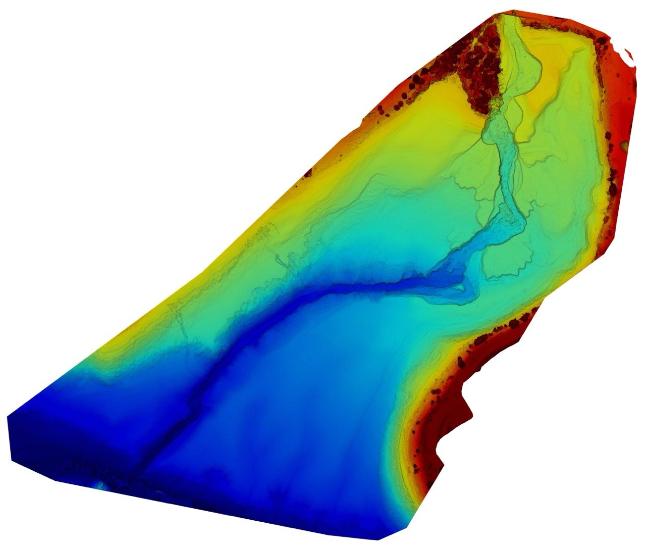
Here are some samples of drone mapping and monitoring services done in the past.

Stream Restoration
Following the removal of four major dams, tributary streams were mapped weekly to inform real-time restoration efforts. A total of 100 acres were mapped with a resolution of 1.4 inches per pixel.
Klamath River Basin, Northern California

Stream Restoration
Ttributary stream mapped bi-weekly to inform real-time restoration efforts. A total of 10 acres were mapped with a resolution of 0.6 inches per pixel.
Klamath River Basin, Southern Oregon

Ability to incorporate ground control points (GCPs) as reference points for increased accuracy.
Ground Control Points
Stream Restoration
Jenny Creek, California. 30 acres were mapped weekly for a period of 3 months to restore the tributary to its natural creekbed and restore critical fish habitat.
Jenny Creek, Northern California